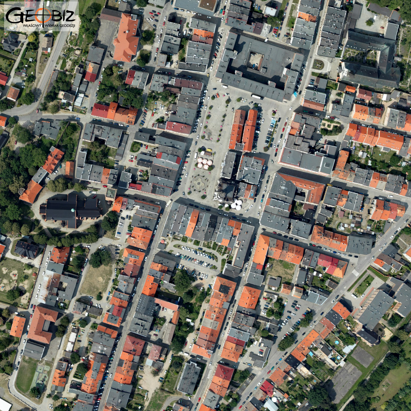
ORTHOPHOTOMAP WROCŁAW-KŁODZKO
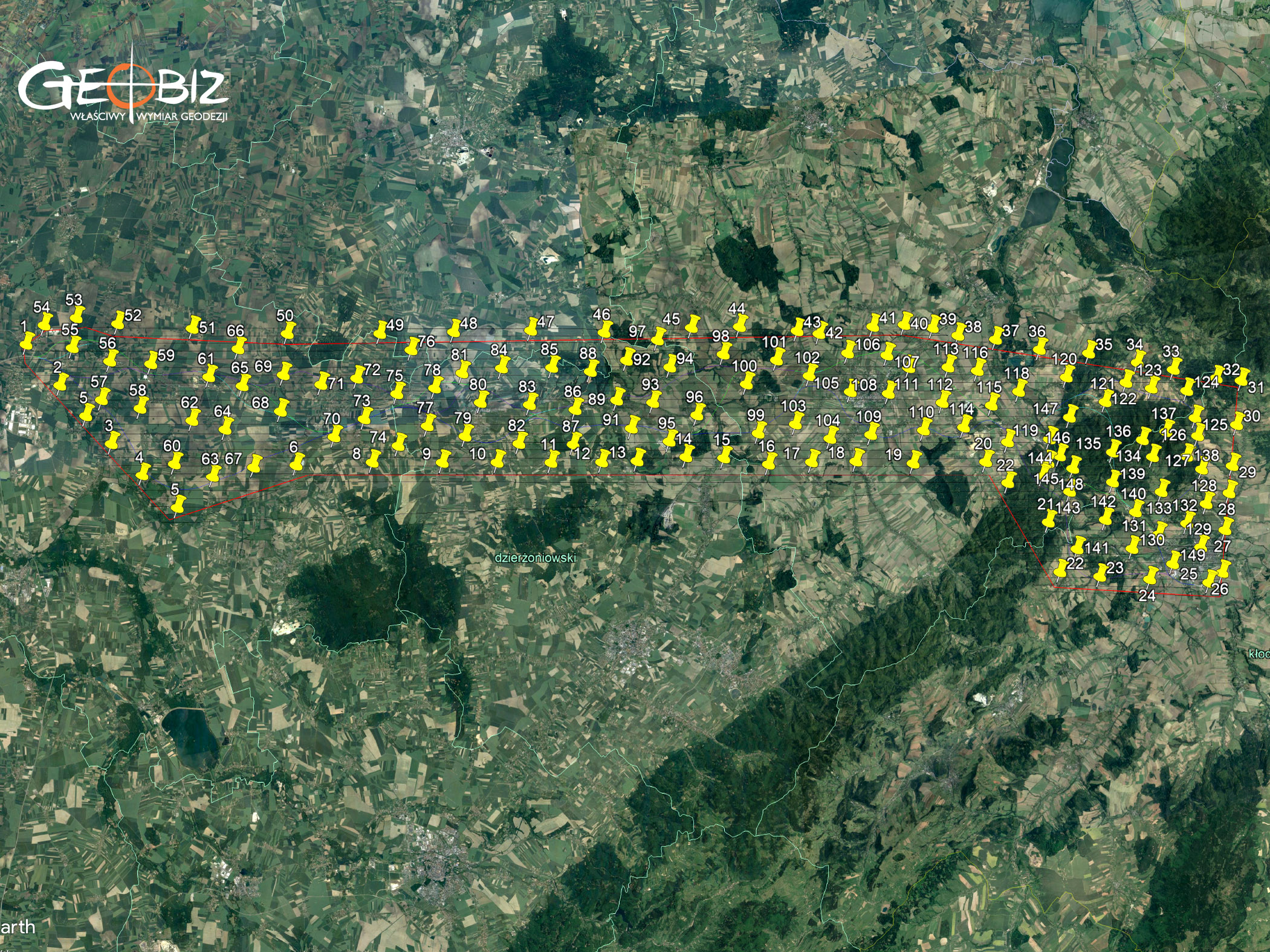
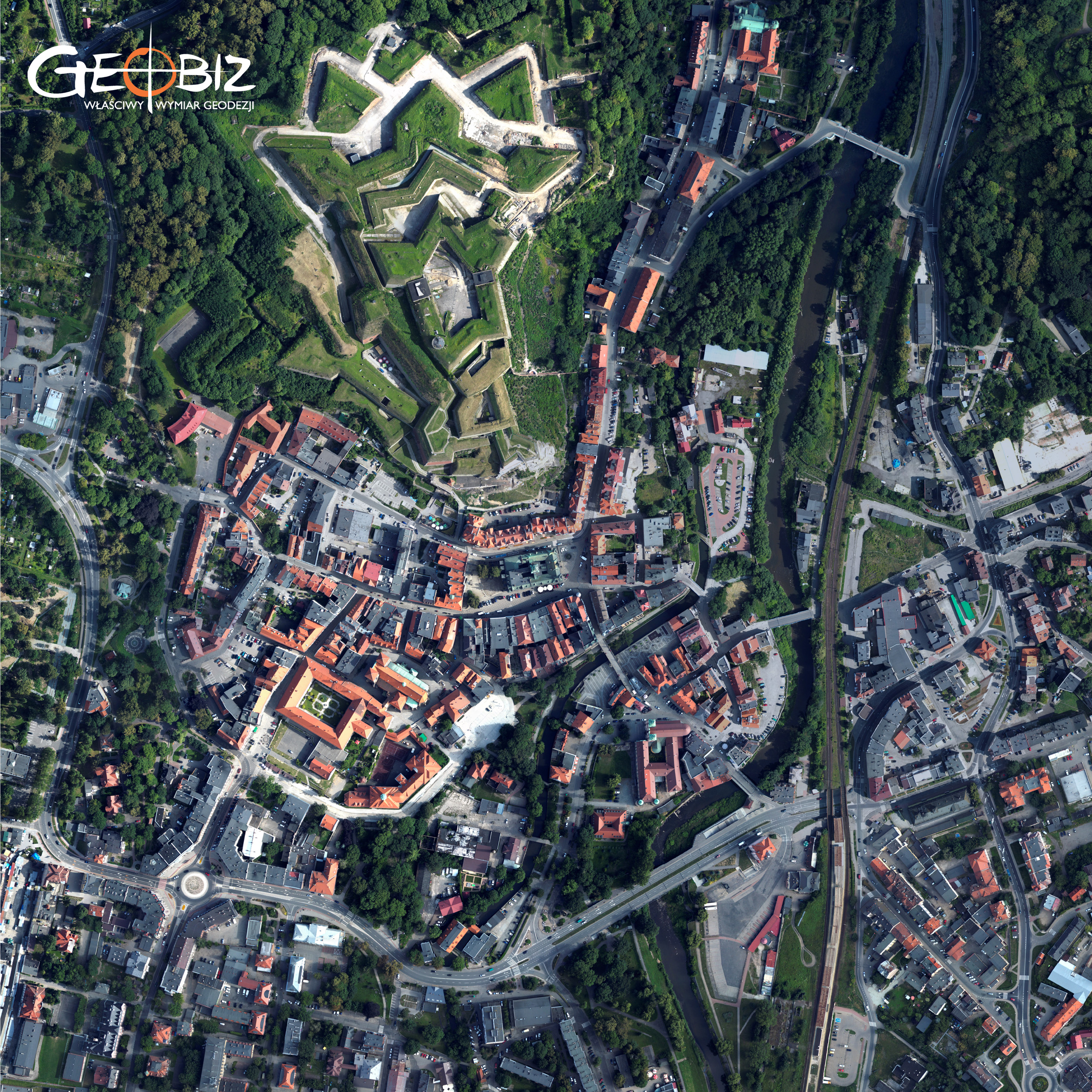
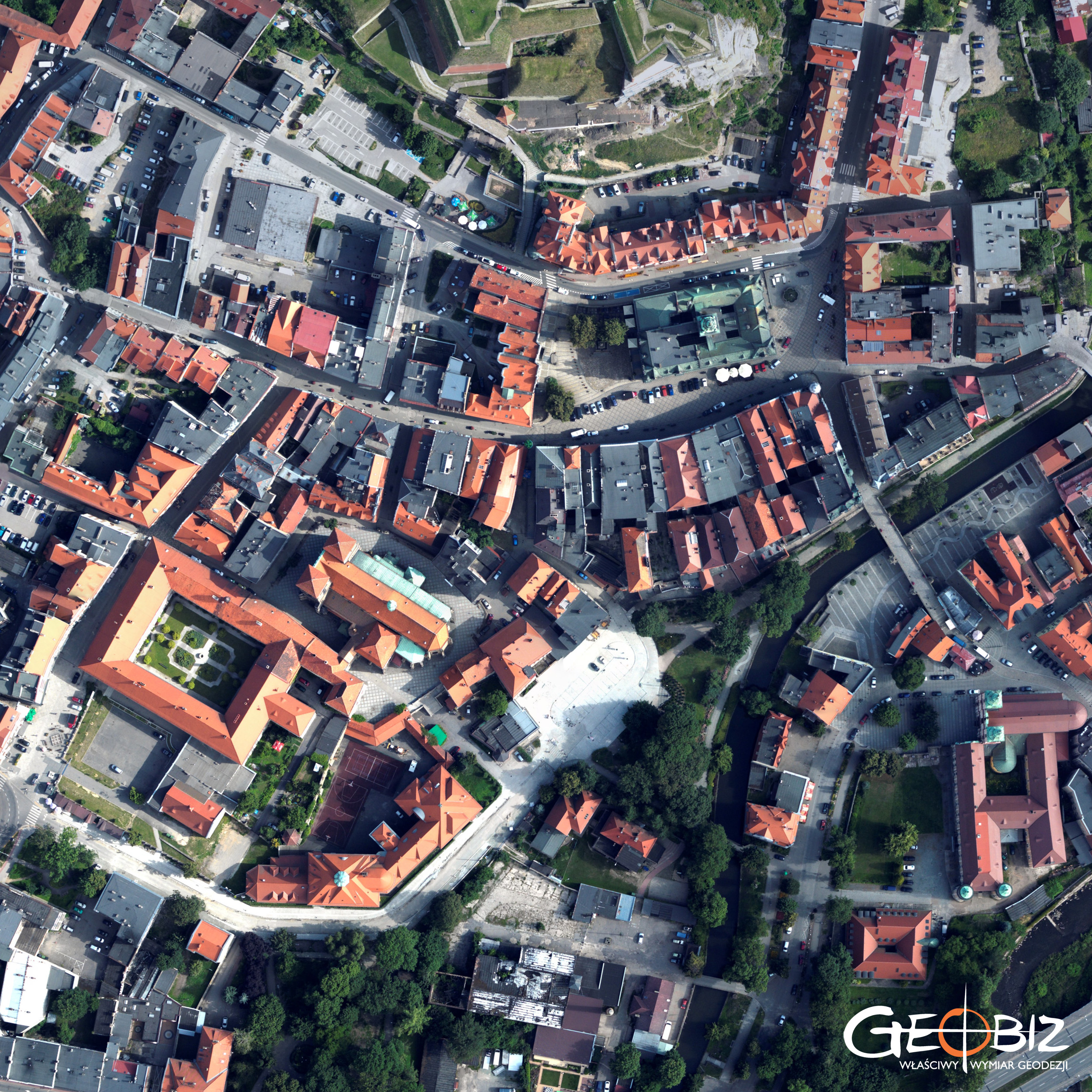
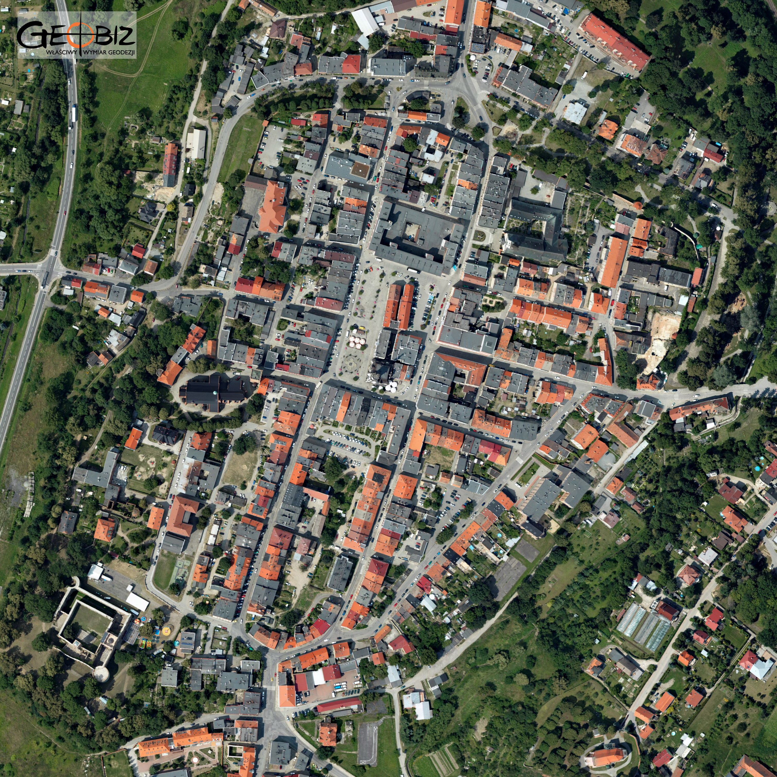
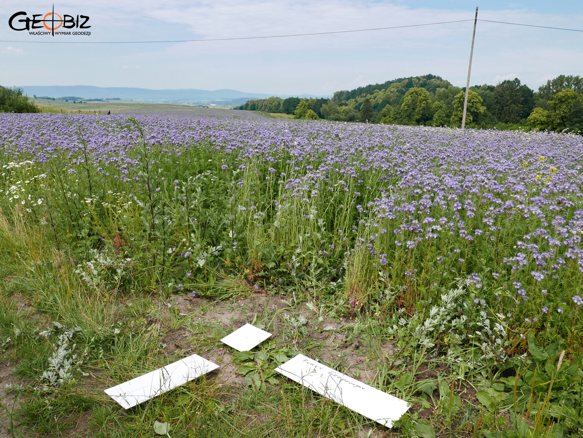
In the summer of 2018, we created an orthophotomap for the concept of the S8 expressway from Wrocław to Kłodzko. The project area covered 570 square kilometers, or 57,000 hectares, with a linear length of 70 kilometers. Given the scope, we opted to use a manned aircraft equipped with a Hasselblad A6D-100C camera. We designed a photogrammetric framework and marked approximately 200 points in the field. Since the area near Kłodzko is mountainous and heavily forested, we decided to increase photo coverage by conducting cross-flights along the main lines and densifying photo points—a decision that proved invaluable for orthophotomap development and quality control of the final product.
This project was a serious test of our computer equipment. Thousands of 100MP RAW images generated gigabytes of data to process—a time-consuming task. All photogrammetric processing was done in Agisoft Photoscan PRO on our multi-processor DELL Precision 7910 workstation, equipped with Intel XEON processors, 256 GB of RAM, and six 1TB SSDs. The graphics cards (four in total) included two latest-generation GeForce cards working in SLI mode and two NVIDIA Quadro cards. We now know that without a high-performance machine like this, tackling large-scale projects isn’t feasible, and liquid cooling and similar setups aren’t just gamer tools for squeezing out extra FPS:)
For us, the best part is that the client is satisfied and there’s potential for future projects like this. The most enjoyable part of the work is laying out and measuring the photo points—especially around Kłodzko. I’m sure we would never have visited such beautiful places if it weren’t for the need to mark the points… Next time, we might need to draw lots to see who goes, as everyone wants a chance to head out, though there aren’t enough points for everyone to get a turn out in the field.
Services in the field Photogrammetry - offer
Orthophotomaps
MAPS AND 3D MODELS OD OPENCAST MINES
PHOTO REPORTS FROM DRONE AND 360 CAMERAS
AERONAUTICAL PHOTOGRAMETRY
INVENTORY OF BULK MATERIAL STOCKPILES
CONSTRUCTION PROGRESS INVENTORY
We perform periodic measurements as the basis for the closure and settlement of construction stages.
CONTACT
We encourage you to send an inquiry, and we will prepare a personalized offer for you.