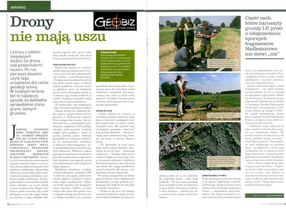
VIOLATION OF THE BORDERS OF THE STATE FORESTS
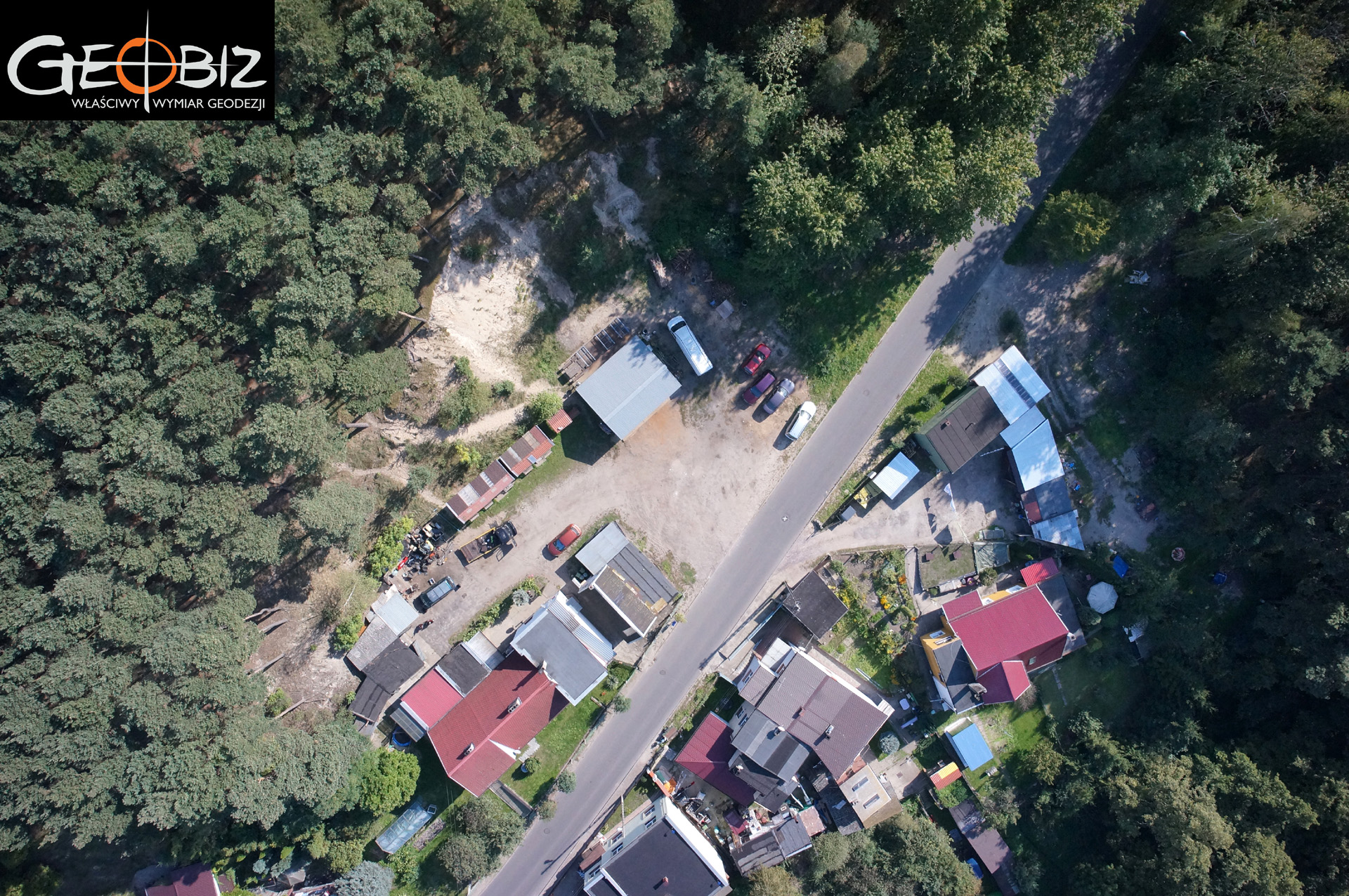
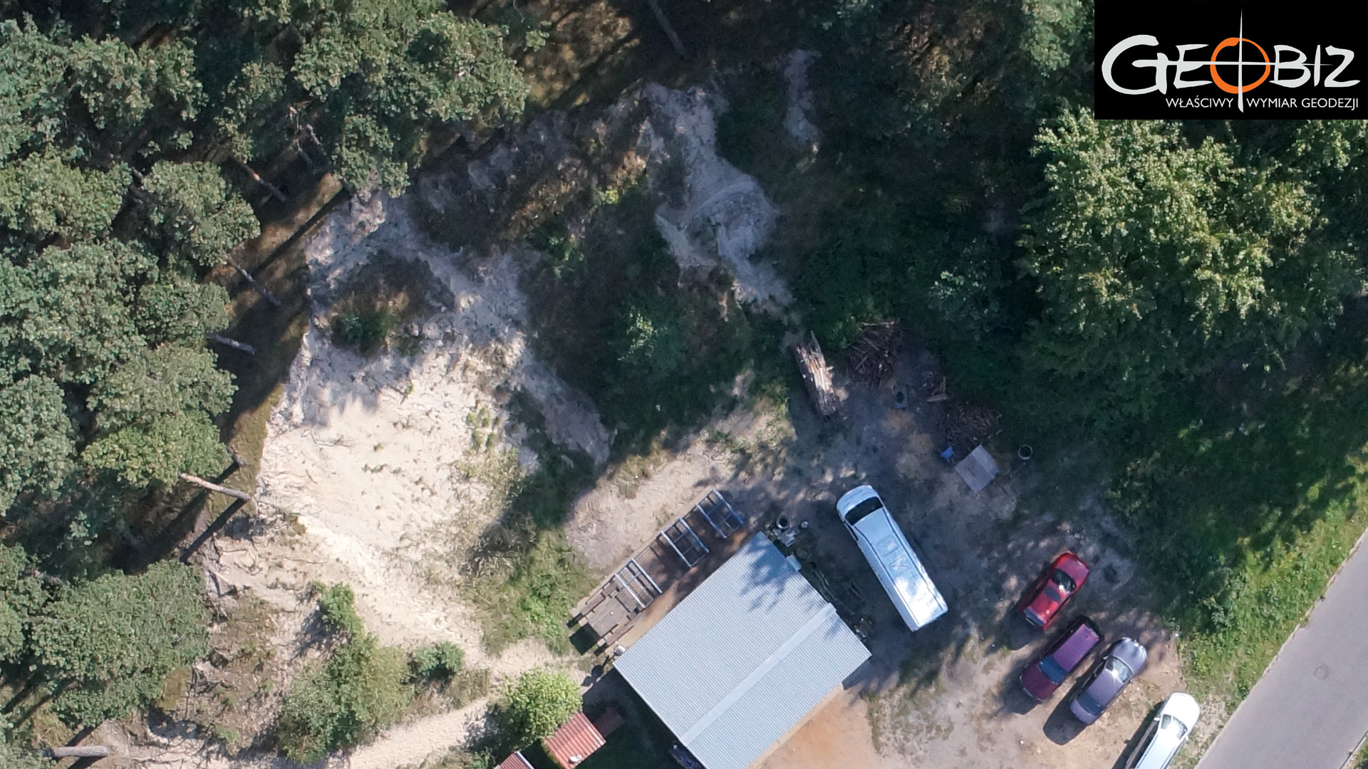
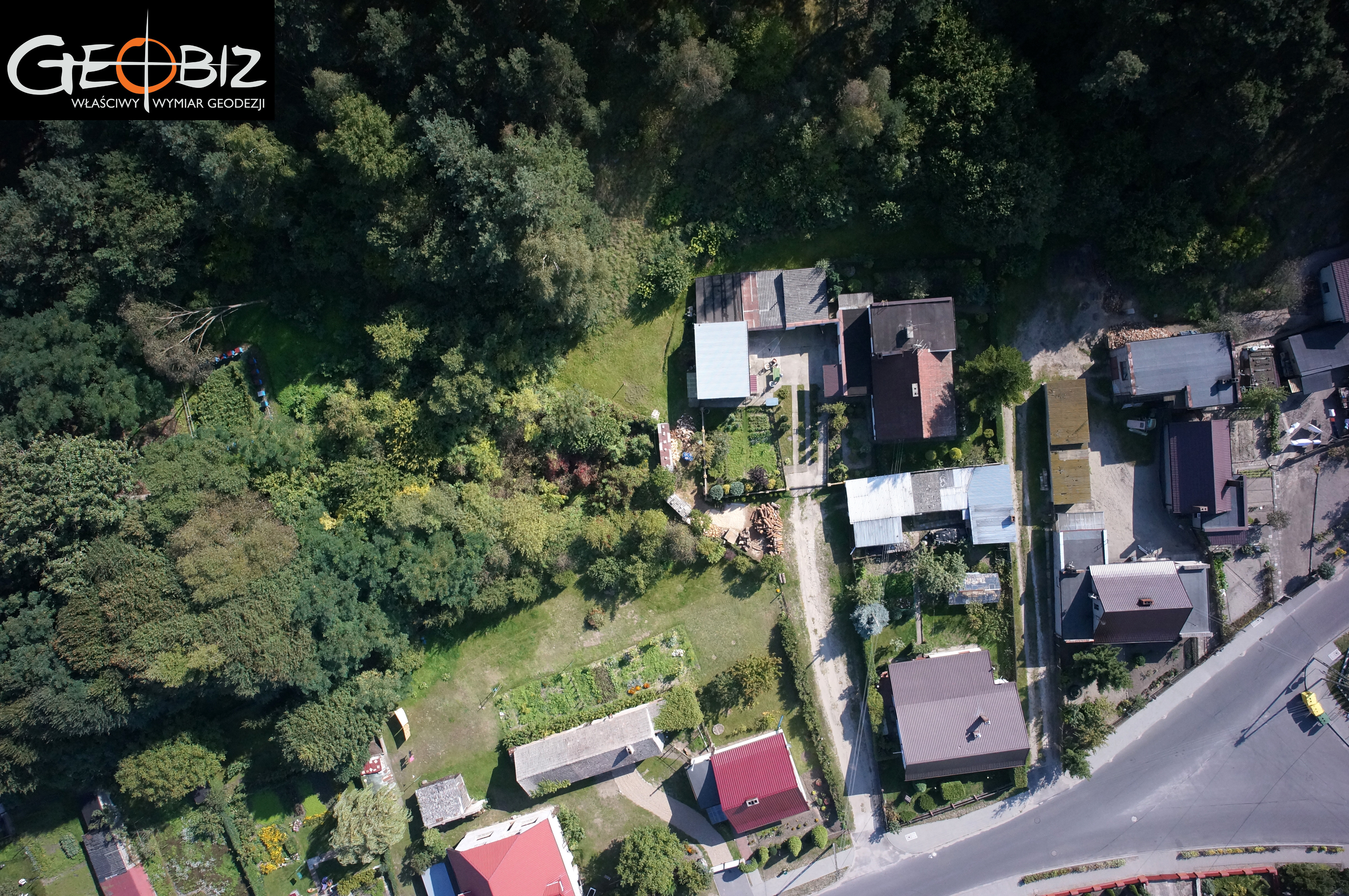
In September 2014, at the request of the Podanin Forest District, we conducted aerial photogrammetry flights aimed at identifying encroachments on the boundaries of State Forests by neighboring property owners.
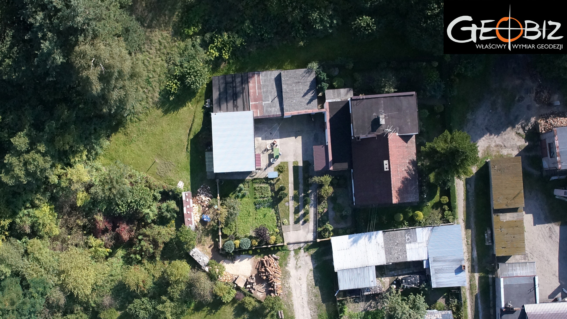
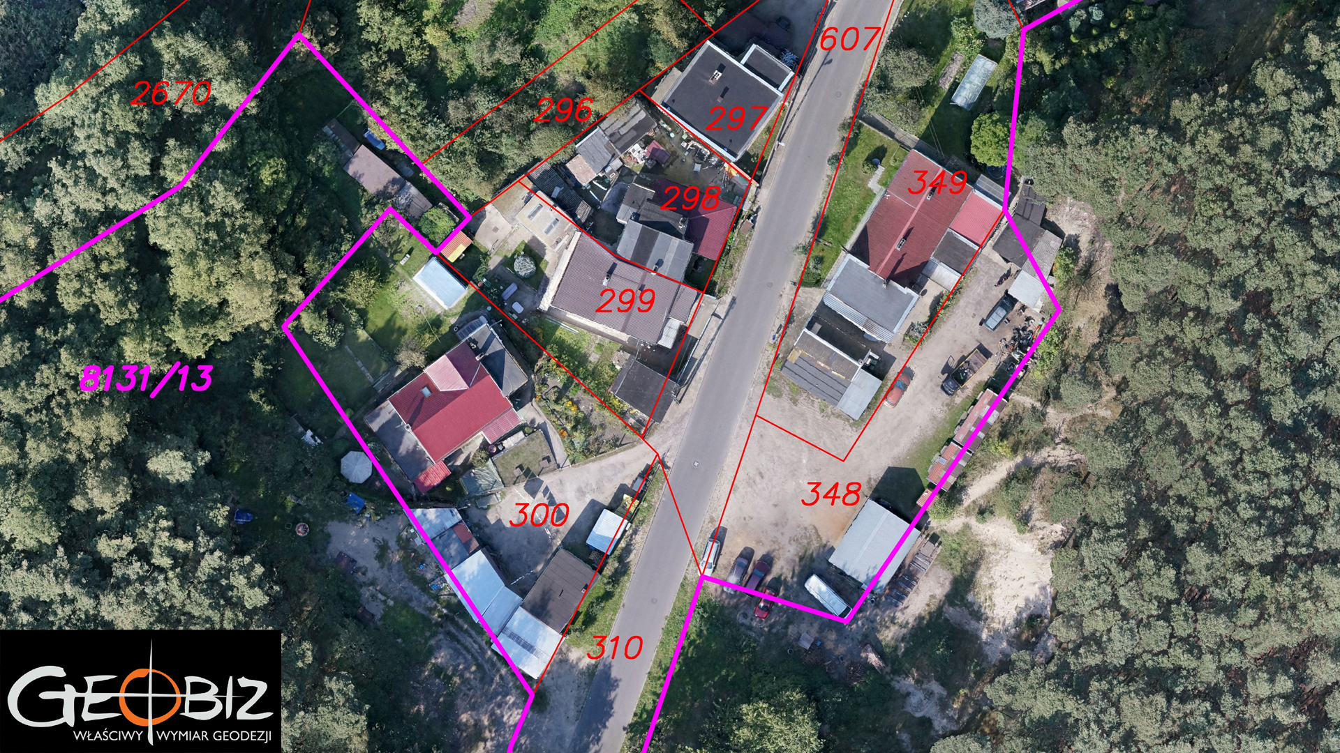
The flights took place over an area near Chodzież, where the urban agglomeration literally overlaps with the forest, resulting in numerous encroachments. We produced an orthophoto map with a resolution of 2.7 cm GSD (ground pixel size) with georeferencing, allowing the ArcGIS system operator at the Forest District to easily integrate our product into the database for further analysis. Additionally, we overlaid a vector land registry map onto the orthophoto, highlighting the boundaries of the parcels belonging to the State Forests. This provided a clear picture of the encroachments and allowed for the precise identification of locations where legal procedures should be initiated to rectify the actual state of the land to match ownership records.
The results of our efforts were detailed in the monthly magazine "Głos Lasu" and resonated widely within the forestry community.
Services in the field Photogrammetry - offer
Orthophotomaps
MAPS AND 3D MODELS OD OPENCAST MINES
PHOTO REPORTS FROM DRONE AND 360 CAMERAS
AERONAUTICAL PHOTOGRAMETRY
INVENTORY OF BULK MATERIAL STOCKPILES
CONSTRUCTION PROGRESS INVENTORY
We perform periodic measurements as the basis for the closure and settlement of construction stages.
CONTACT
We encourage you to send an inquiry, and we will prepare a personalized offer for you.