MODELING OF INDUSTRIAL PLANTS
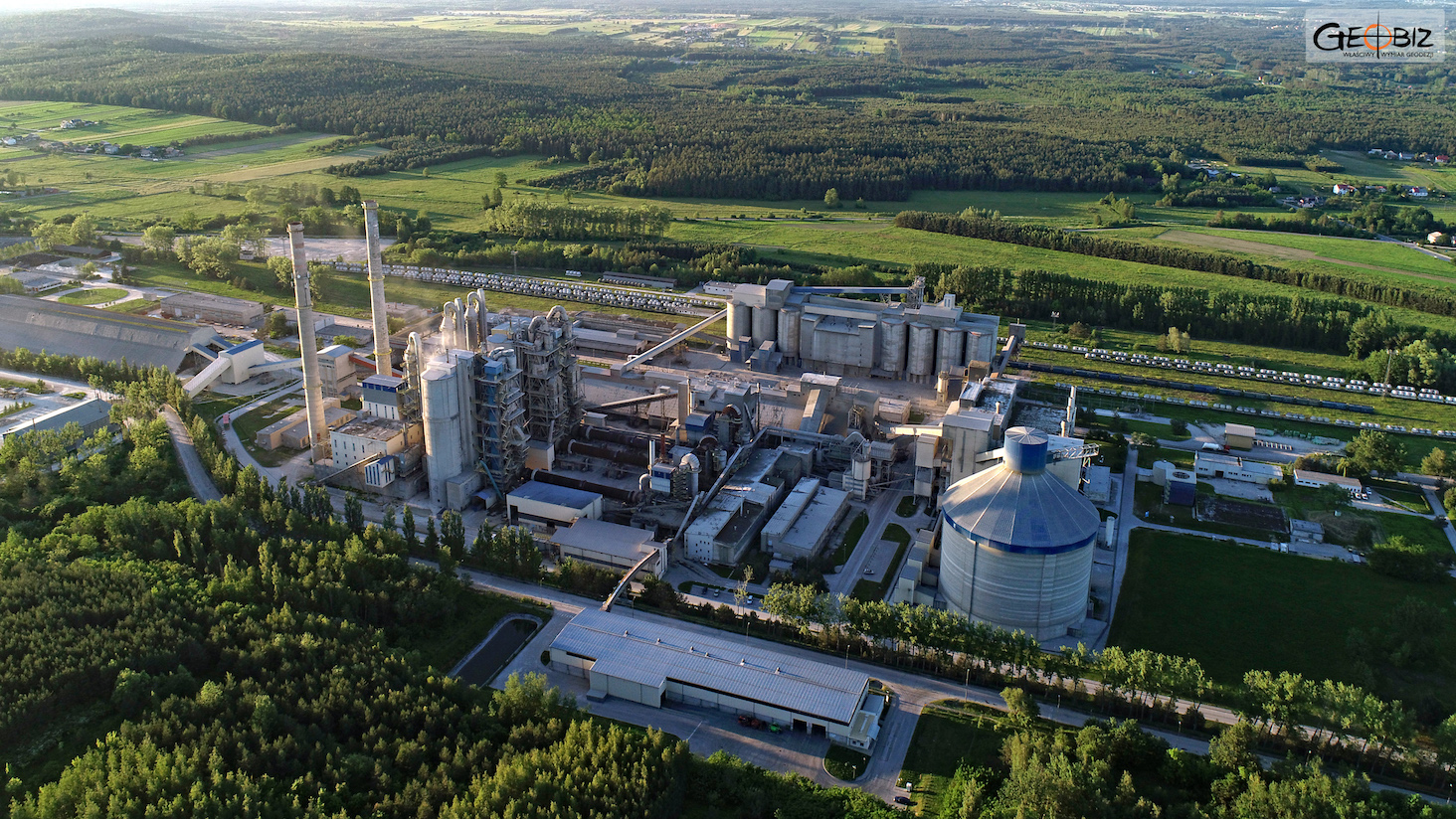
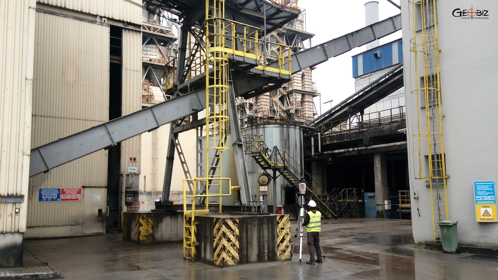
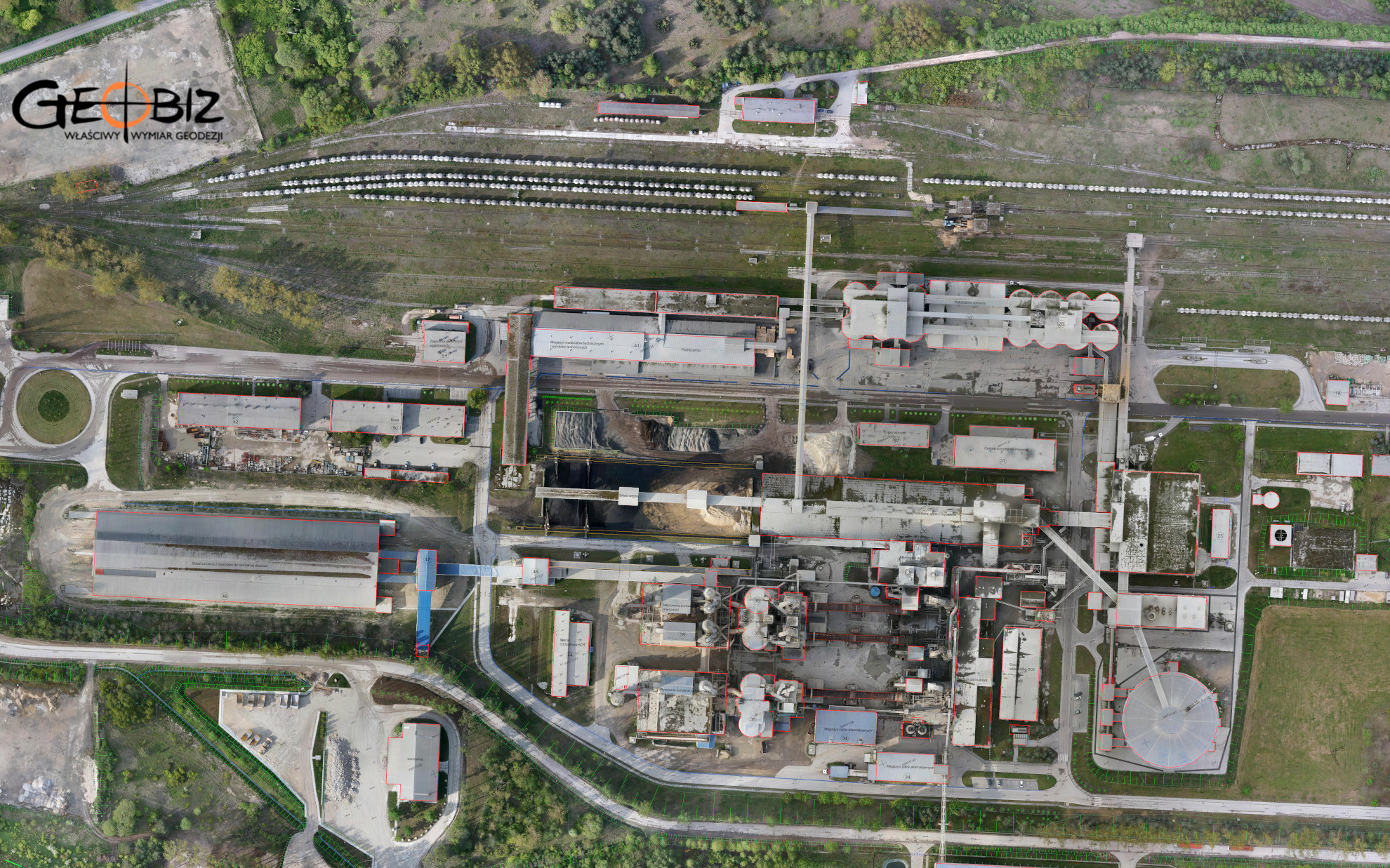
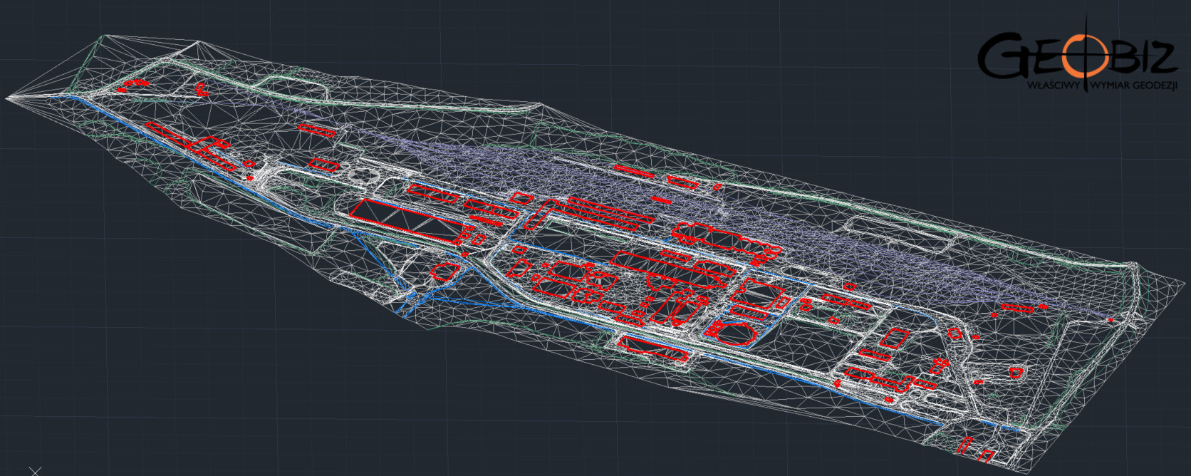
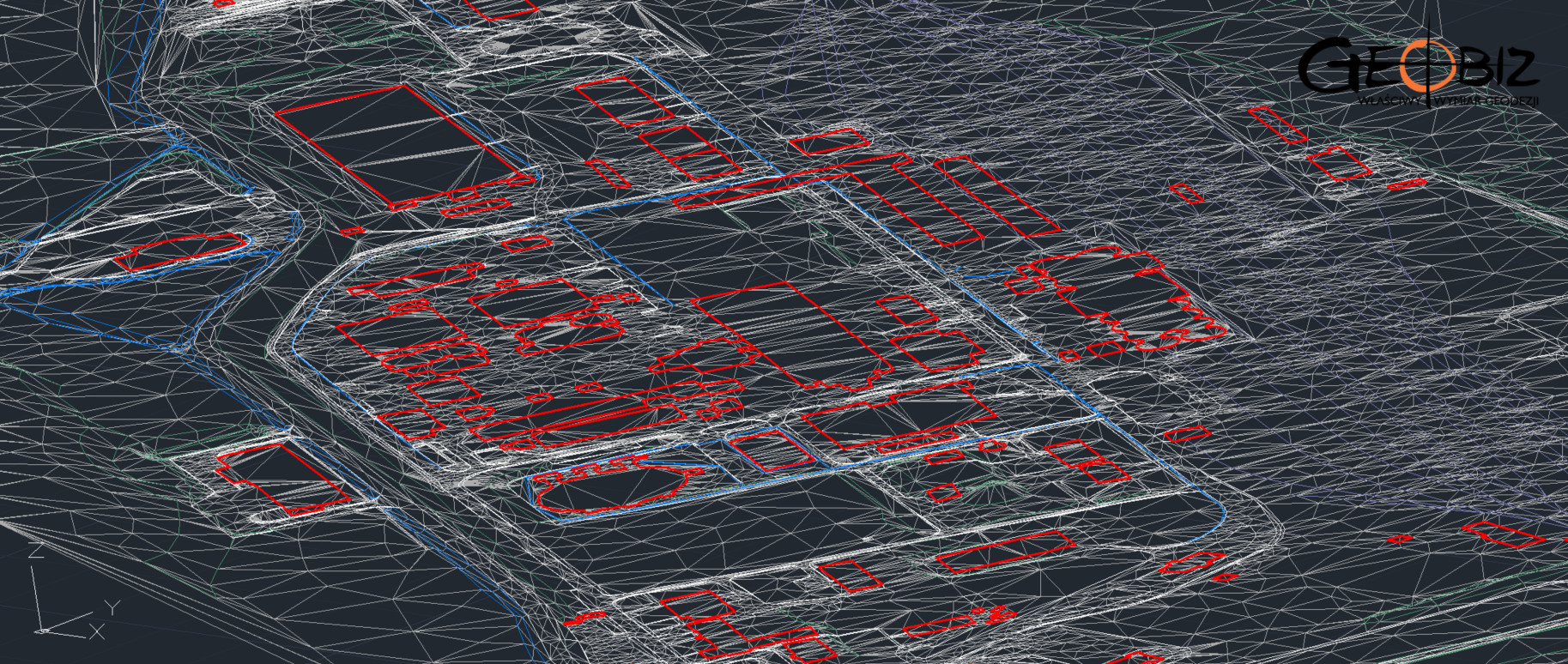
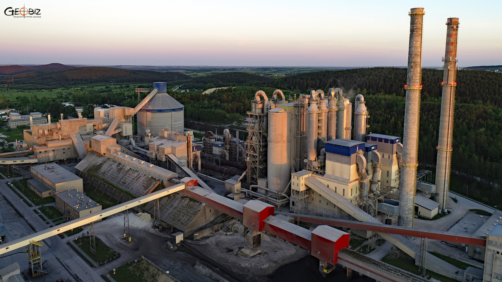
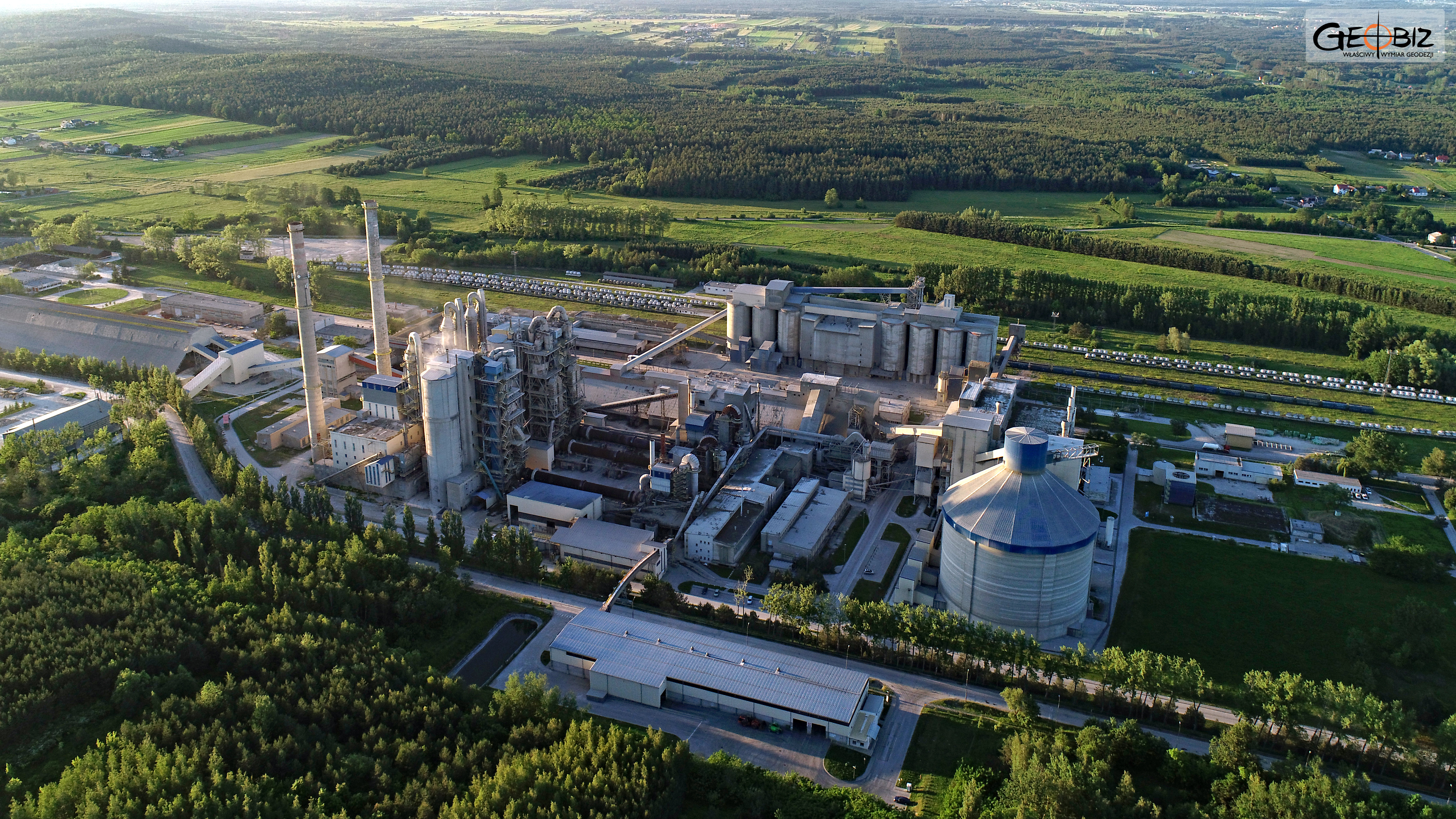
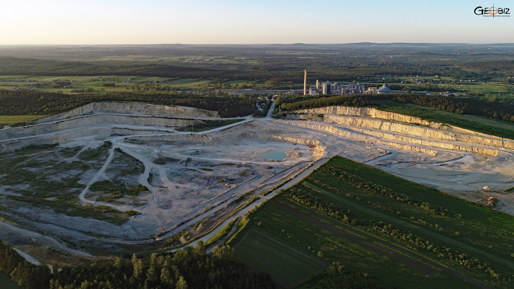
On behalf of a corporation owning a cement plant, we conducted extensive measurements and photographic documentation of the facility. We created a digital terrain model of both the industrial area and the open-pit mine in LandXML and DWG formats. Data for the model was collected using laser scanning methods with a RIEGL VZ400i laser scanner and close-range photogrammetry data.
We also generated a virtual tour of the facility based on 360-degree photos. The main product, of course, was a fully three-dimensional design map along with an orthophotomap.
Services in the field Skanning 3D - offer
CONSTRUCTION AND ARCHITECTURAL INVENTORIES
Reverse documentation based on laser scanning data
VOLUME OF PRISMS UNDER ROOFS AND IN HALLS
Inventory of loose materials in warehouses under the roof and in the halls.
DIGITAL TERRAIN MODEL
3D terrain modeling based on point clouds from laser scanning and photogrammetry.
BUILDING AREA MEASURMENT
Measurement of the usable area of buildings in accordance with applicable standards.
BALANCE OF EARTH WORKS
Calculation of the amount of earthworks actually performed
INVENTORY OF DAMAGES AND MONITORING CHANGES
Precise measurement of damage after collisions and accidents
CONTACT
We encourage you to send an inquiry, and we will prepare a personalized offer for you.