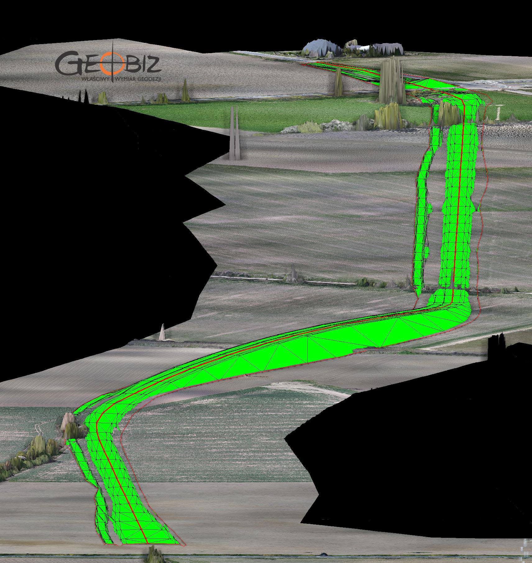
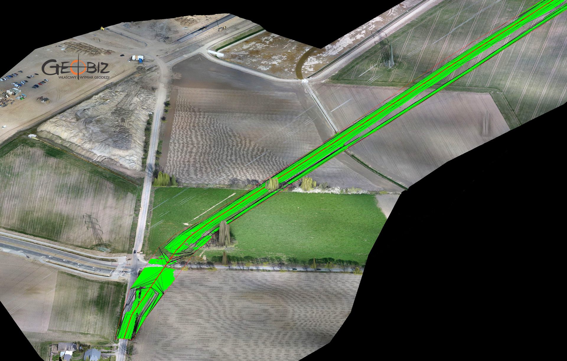
BALANCE OF EARTH WORKS
DESIGNED EARTHWORKS BALANCE
More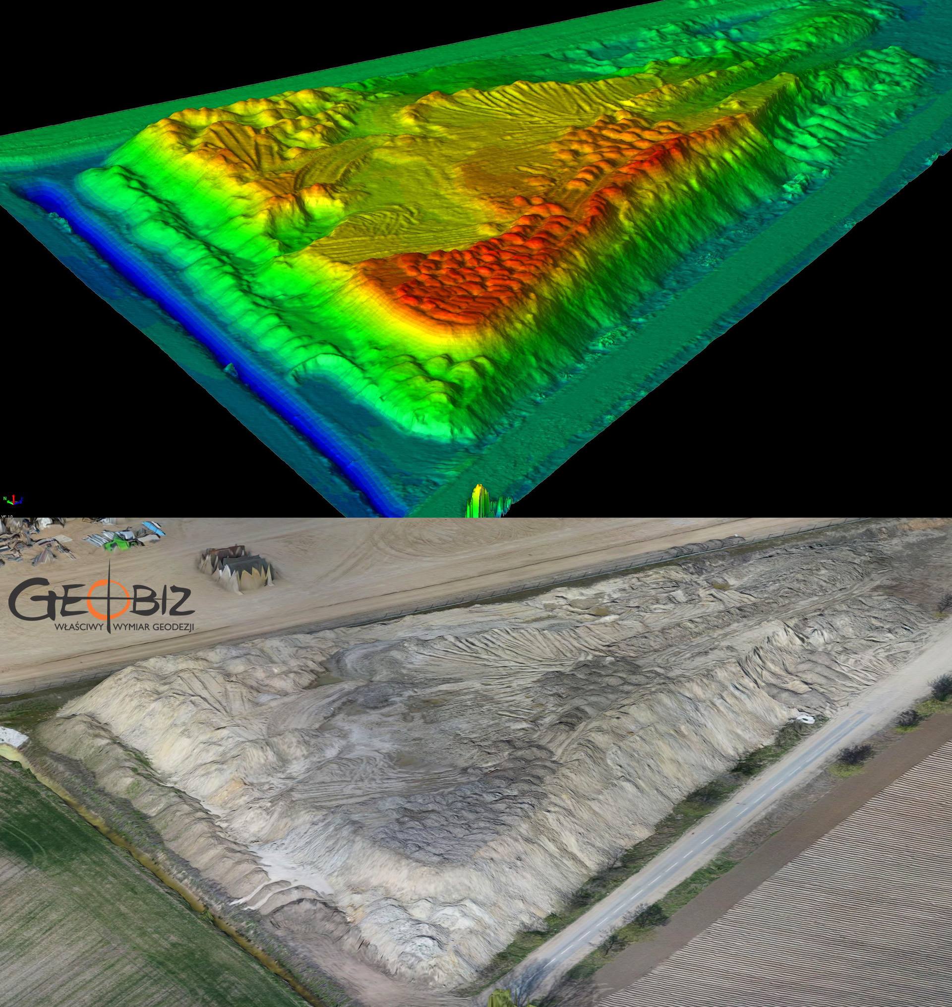
INVENTORY OF EARTHWORKS
Measurement and calculation of the quantity of earthworks actually completed.
More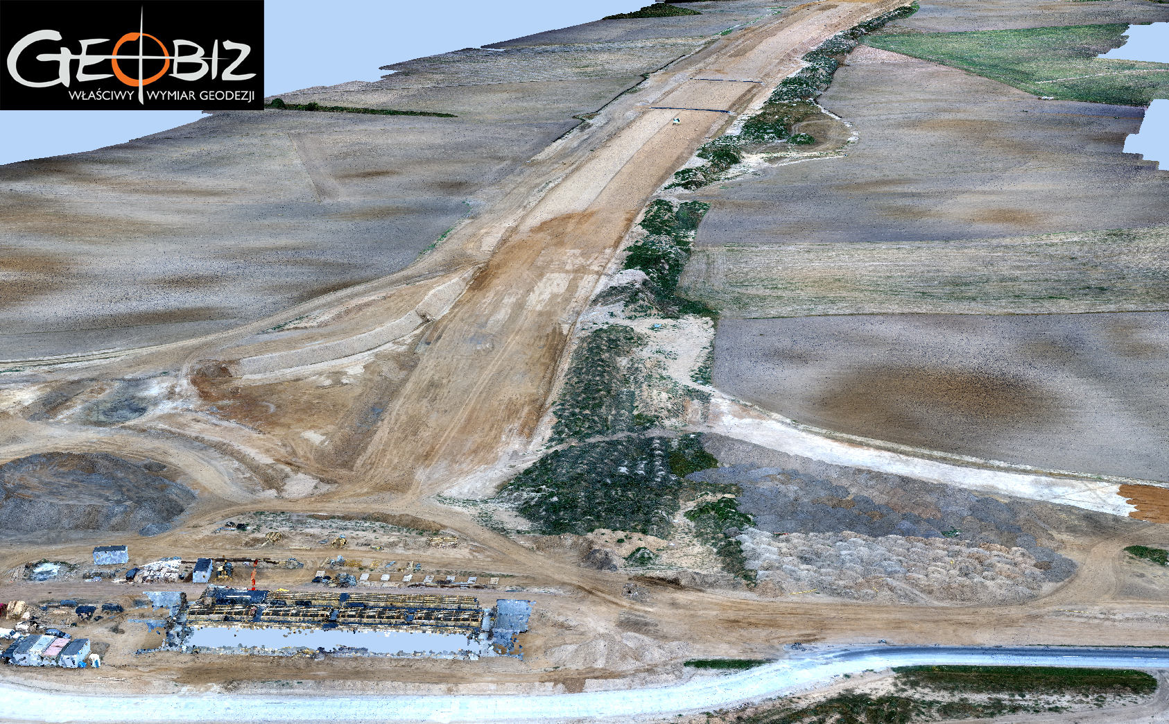
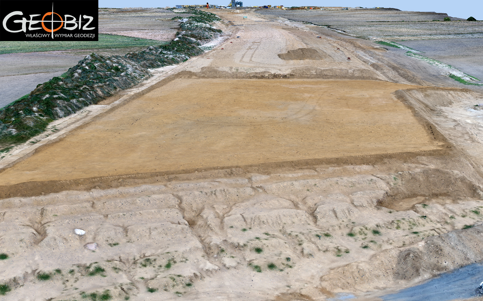
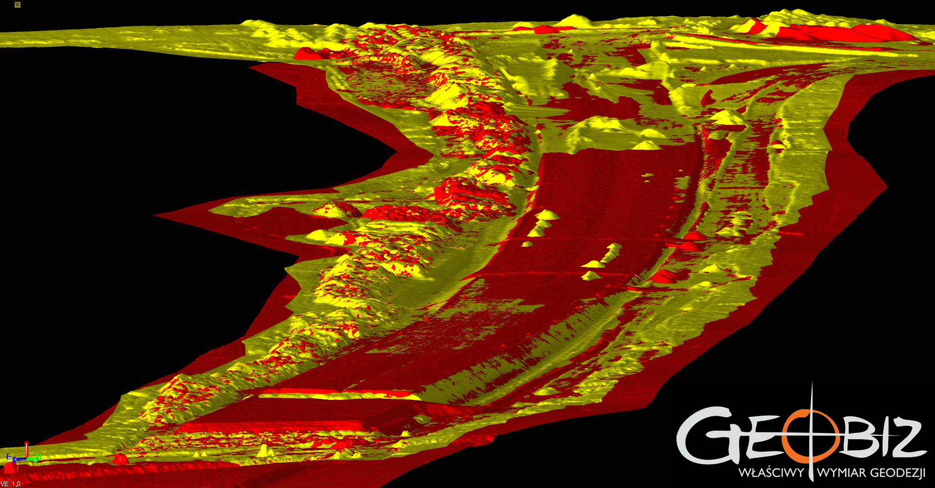
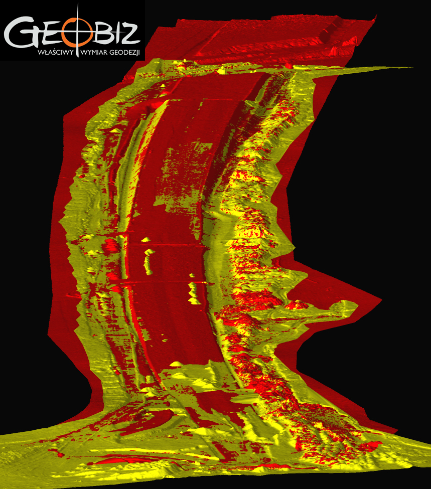
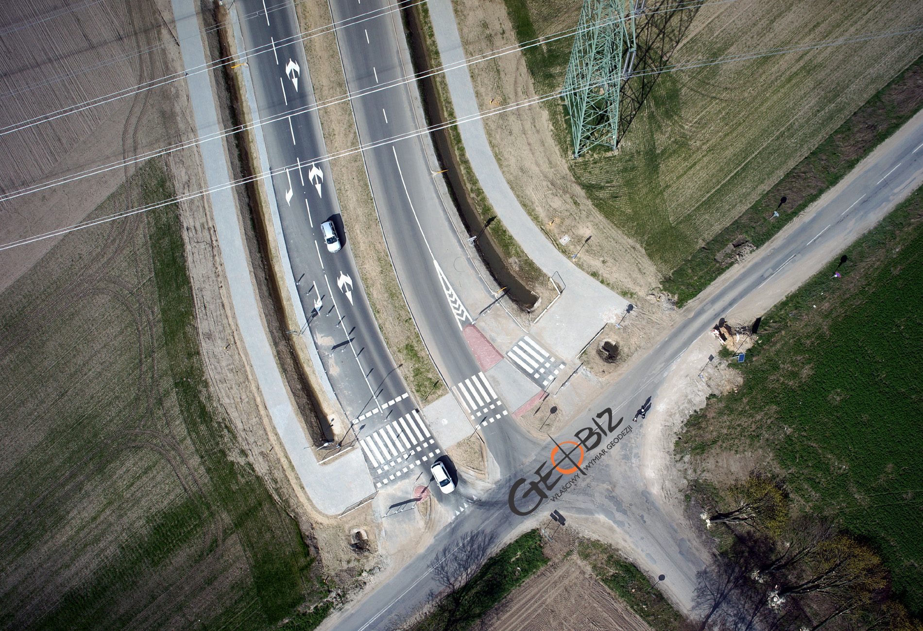
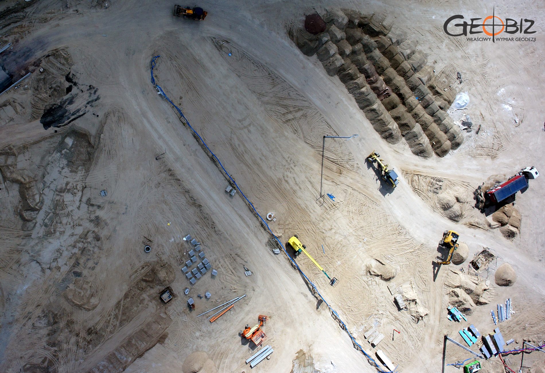
Volume Measurement of Earthworks in Poznań
In any open-pit mine or bulk material storage, effective inventory and calculation of material volumes become a key element for proper operation. For any construction, accurately calculating the projected earthwork balance is crucial for correct project bidding. The methods for measuring earth volumes are diverse, and their application allows for obtaining precise data on the amount of earth to be excavated or filled, as well as providing information on whether the balance of work is zero or if costly material transportation is required, which is essential for proper planning of subsequent construction stages. Therefore, an appropriate approach to measuring earth volumes in Poznań can significantly impact cost optimization and project timelines.
Modern Measurement Technologies
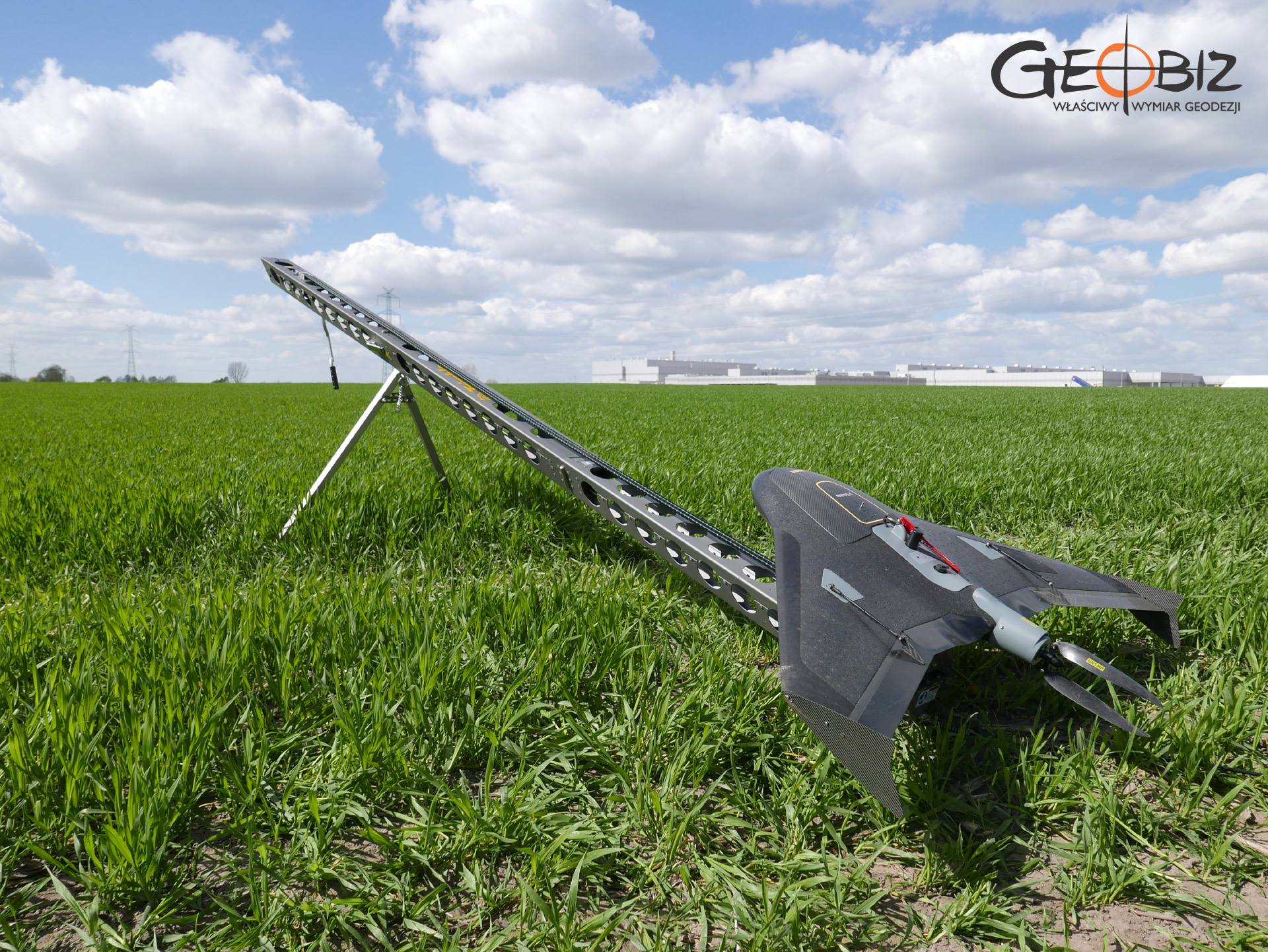
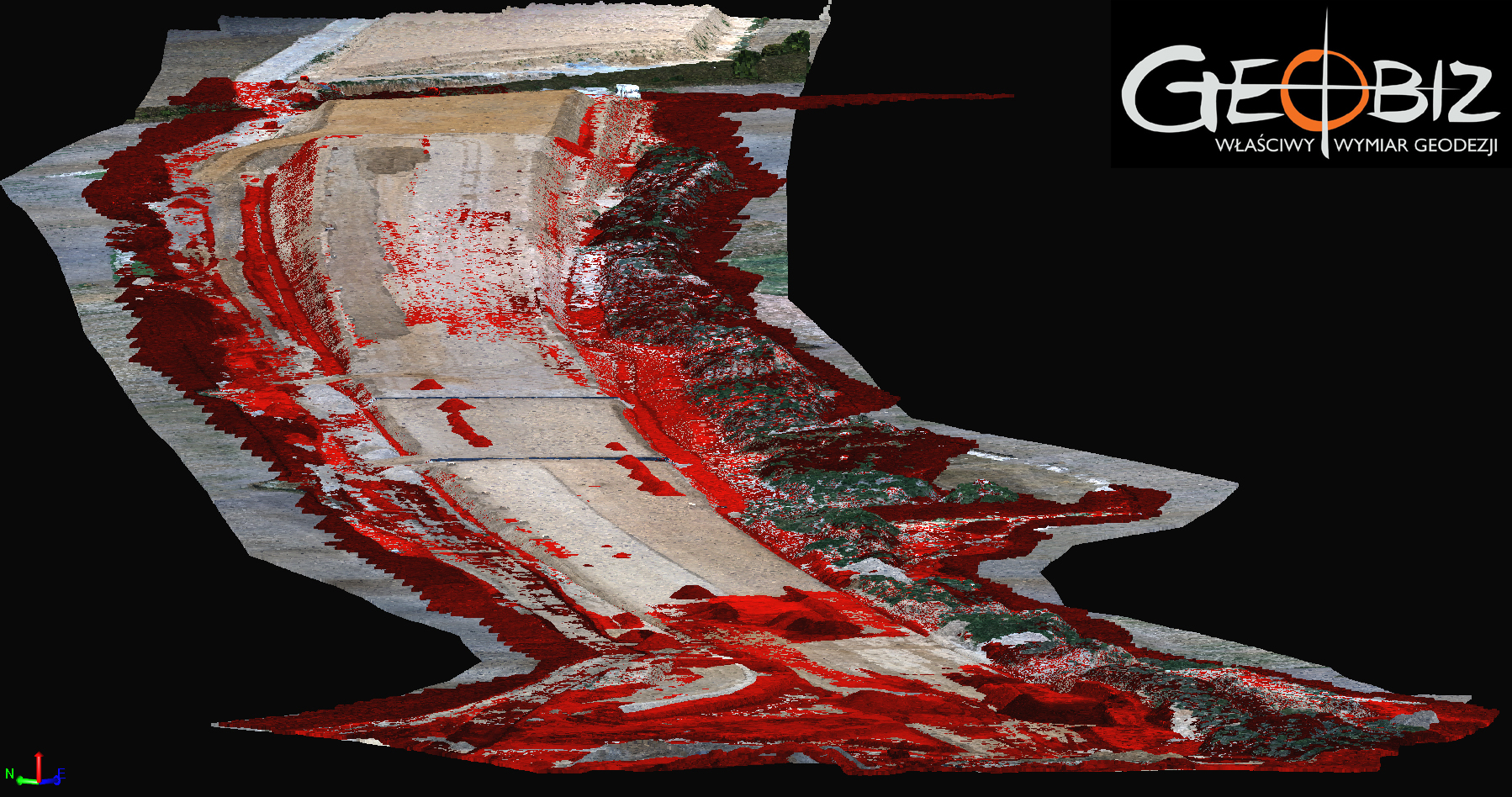
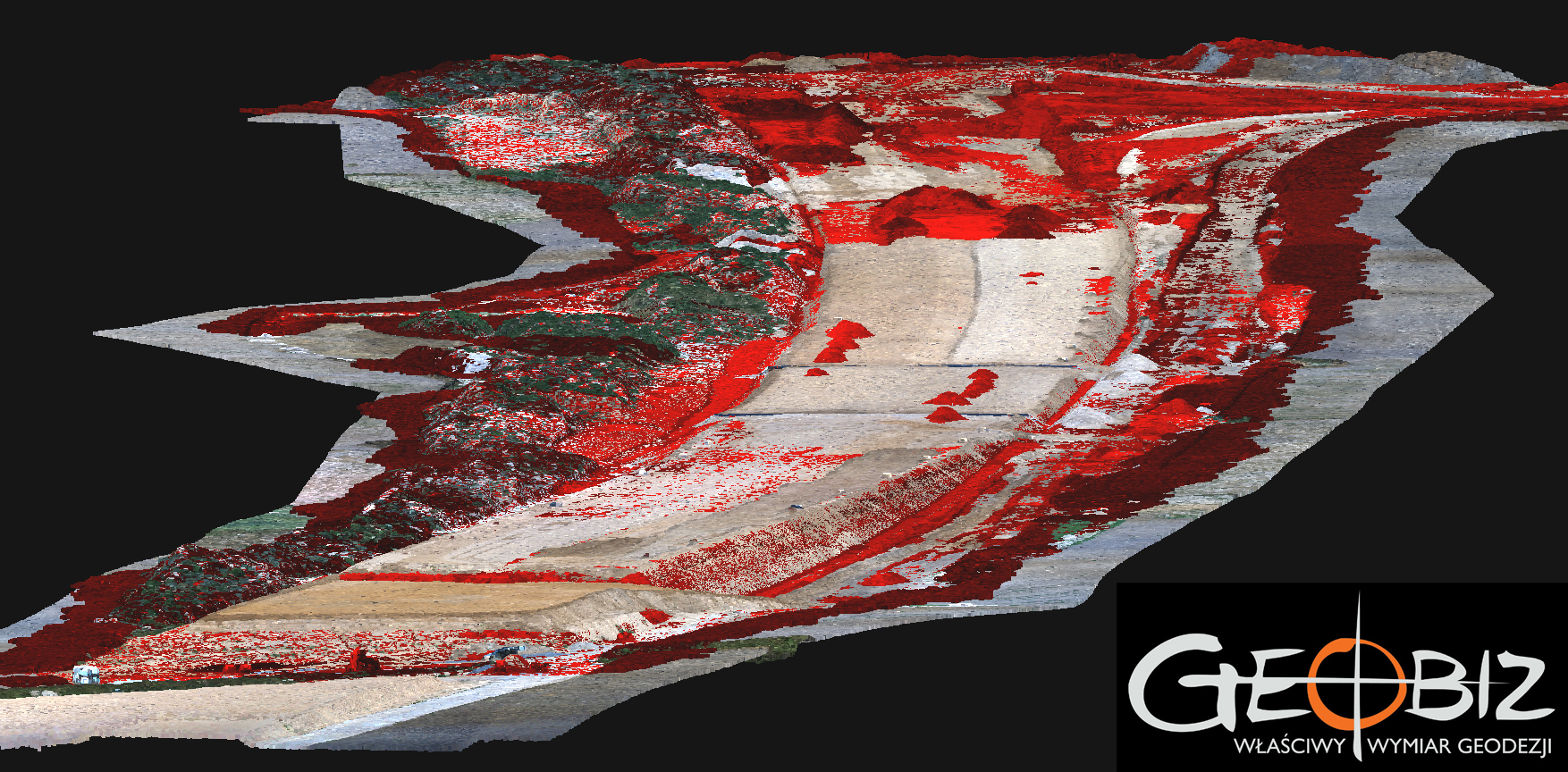
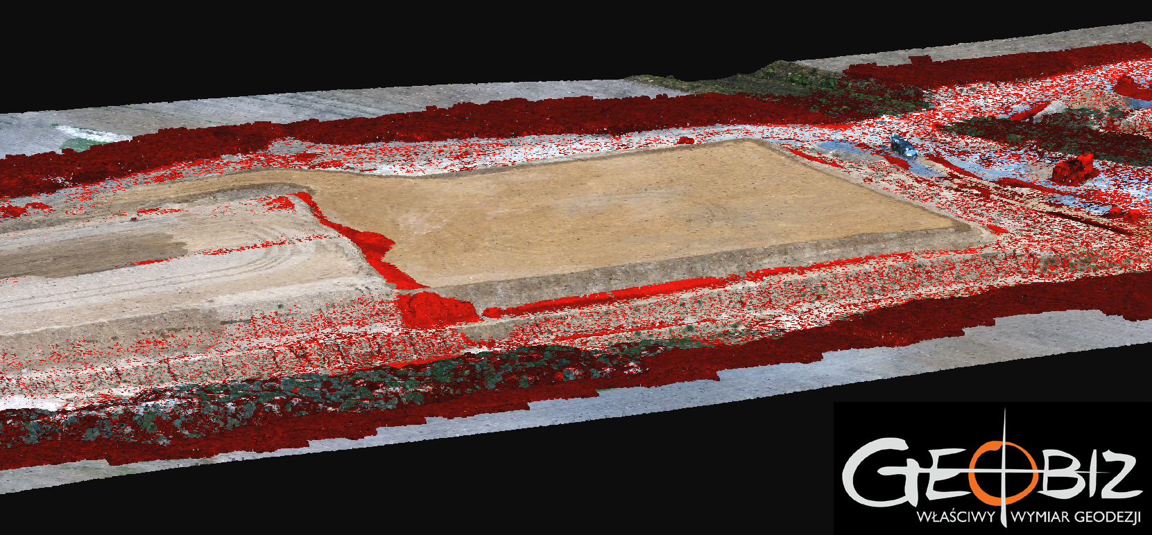
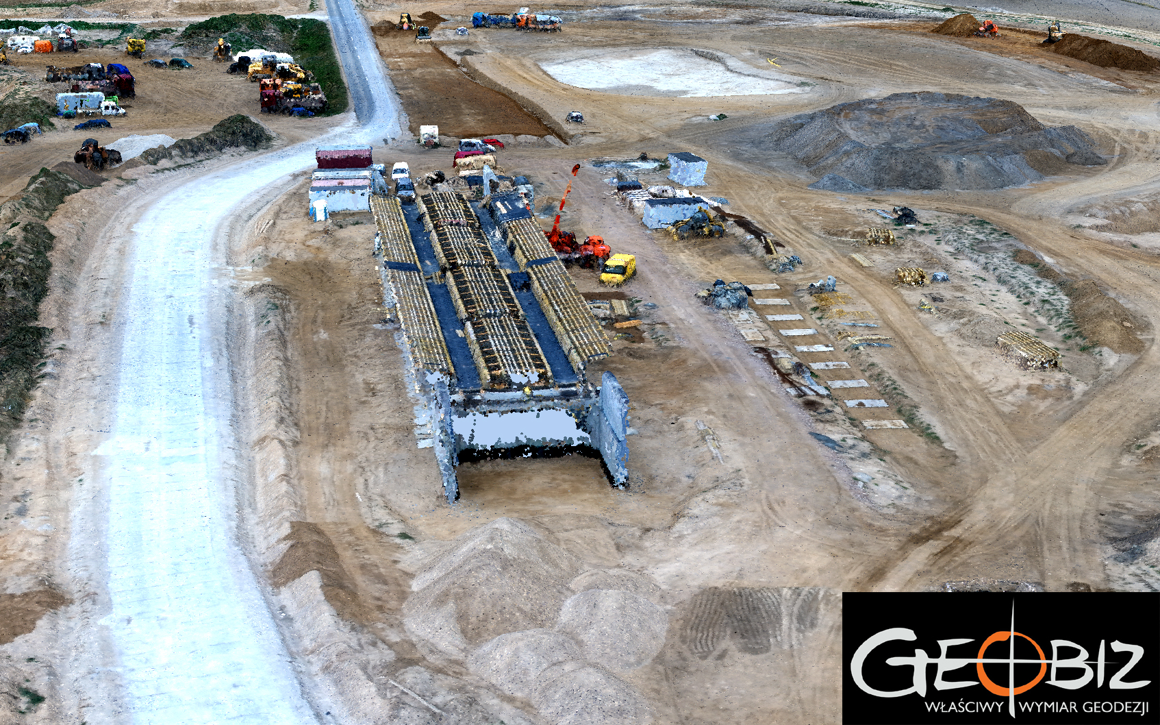
In the process of measuring earth volumes in Poznań, modern technologies such as laser scanning are significant tools. We mainly use the RIEGL VZ 400I laser scanner for scanning terrain and construction objects. This is a pulse scanner with a scanning range of up to one kilometer, making it ideal for open-space scanning. By splitting the laser beam (up to sixteen times), it allows for collecting terrain data even in challenging conditions, such as dense tree cover or overgrown areas. The speed and range of individual scans allow us to inventory large areas in a relatively short time. For architectural measurement tasks, we also utilize the FARO phase scanner. This device has a slightly different specification and measurement execution method than the RIEGL scanner but is perfect for all building inventories. When measuring stockpiles of bulk materials, we use close-range photogrammetry. Aerial photographs are obtained using various drone models, from wings launched from special launchers (Trimble UX5 model) to multi-rotor units from DJI. Materials stored under roofs are modeled based on data acquired through laser scanning in cases where safe drone flights are not possible.
Precision and Data Analysis
Accurate measurement of earth volumes in Poznań requires not only appropriate tools but also advanced computational methods that allow for interpreting collected data. By combining laser scanning with analysis software from RIEGL and Trimble, specialists can obtain precise volumes of excavations and fills, significantly saving time and costs in project execution. In construction investments such as road or bridge construction, precise data on earth volumes are essential to ensure safety and efficiency in construction work. Measuring earth volumes in Poznań is one area where our services can significantly support project implementation.
The Role of Measurements in Construction Project Management
Measuring earth volumes in Poznań is a process that requires both modern technologies and a skilled workforce. Collaborating with us allows for obtaining precise and reliable data, which are crucial for planning and executing construction projects. Our years of experience in the industry and advanced measurement tools ensure the highest quality of services, minimizing risks and optimizing costs. Thanks to our measurements, clients can better manage resources and plan construction schedules, contributing to the overall success of the project. Today, we can proudly say that GEOBIZ was one of the first companies in Poland to apply close-range photogrammetry for reporting earthwork balances and modeling terrain during the construction of express roads and highways.
Offer for Clients
For clients who can work with point clouds, we offer a solution involving the delivery of a pre-cleaned point cloud for further processing. We can embed any cloud in a geodetic coordinate system at the correct elevation and provide data in any format and resolution. We prepare point clouds in both RGB colors corresponding to real-world colors and in colors reflecting reflection parameters (which in many cases is sufficient and significantly reduces data acquisition costs). Often, ordering a raw point cloud is very financially beneficial. Our scanners are very fast, so collecting even large amounts of data does not have to incur significant costs. Usually, further processing generates much higher costs than the data acquisition itself. We invite you to take advantage of our offer for obtaining point clouds using laser scanning and close-range photogrammetry.
CONTACT
We encourage you to send an inquiry, and we will prepare a personalized offer for you.